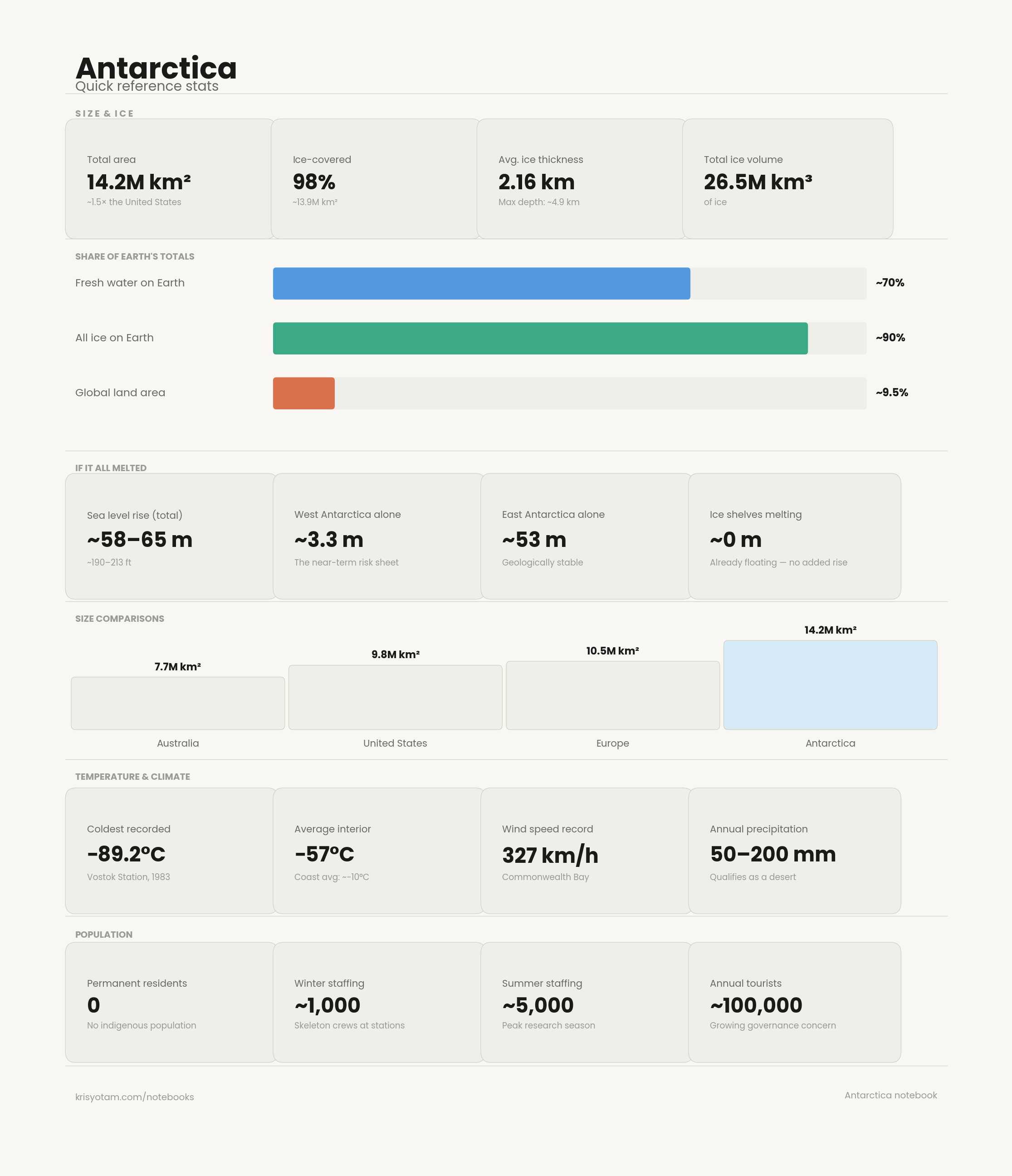
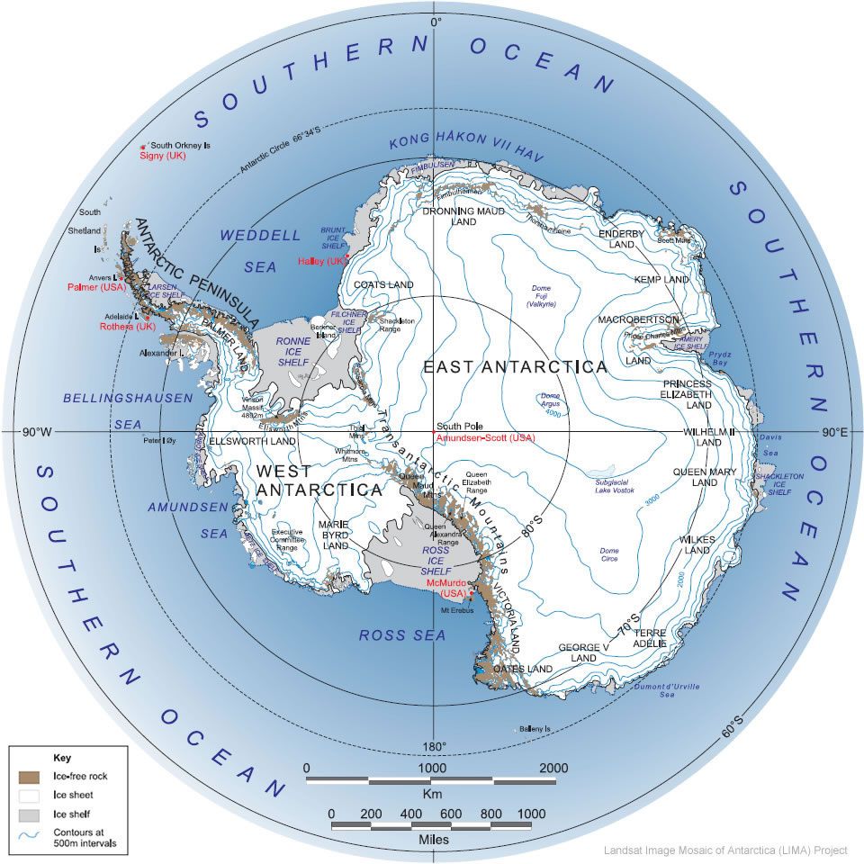
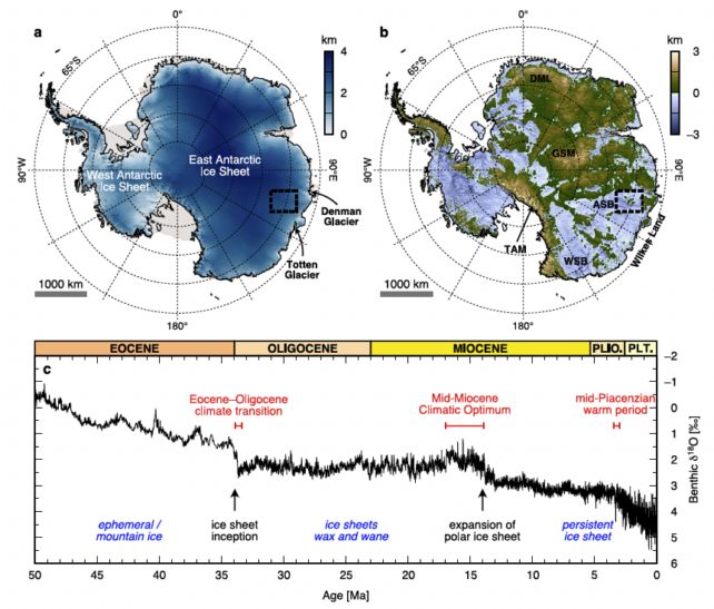
Antarctica has got to be one of the most ethereal places on earth. With an area of ≈5.5M sq mi (≈14.2M km²) it is 98% ice-covered, ≈13.9M km² of which is ice, with an average ice thickness of 2.16 km and a total ice volume of 26.5M km³. Antarctica holds ≈70% of Earth's total fresh water, ≈90% of all the ice on earth, and ≈9.5% of the global land area. If it all melted we would see a sea level rise of 58–65 m (190–213 ft), with West Antarctica alone contributing ≈3.3 m. For context on size: US 9.8M km², EU 10.5M km², AUS 7.7M km², and Antarctica a staggering 14.2M km². Temperatures can also get ludicrously cold here, with the coldest recorded temperature being in Vostok at -89.2 °C (-128.6 °F), an average interior temperature of -57 °C, a wind speed record of 327 km/h at Commonwealth Bay, and annual precipitation of ≈50–200 mm which does classify Antarctica as a desert. When I was a bit younger I frequented maladaptive daydreaming of what it would be like to take up residence in a place so glorious. Sadly this hasn't stopped even since learning about the Antarctic Treaty. The Antarctic Treaty of 1959, with 57 current signatories, is responsible for Antarctic governance. The treaty demilitarizes the continent and freezes claims to territory. Seven states hold formal territorial claims (Argentina, Australia, Chile, France, New Zealand, Norway, UK), three of which overlap in the Antarctic Peninsula, whereas Russia and the United States could be more fairly classed as semi-claimants because they reserve the right to make a formal territorial claim in the future. The Treaty's Article IV is a masterpiece, neither validating nor extinguishing existing claims, simply suspending them in legal permafrost.
The scientific presence in Antarctica is fairly tame: a population of ≈1,000 people across all stations in the winter, with the summer reaching ≈5,000 people. The tourist presence is fairly healthy however, with ≈100,000 per year (a significant number when compared to just the 90s). The continent is effectively the planet's primary climate archive, with sites like Concordia (Dome C) and Vostok preserving trapped atmospheric gases dating back hundreds of thousands of years. In early 2025, the Beyond EPICA project successfully drilled a 2,800 m ice core representing more than 1.2 million years of Earth's climate history. Subglacial research is just as interesting, with scientists using radar altimetry data from the ESA's CryoSat-2 to identify 85 new subglacial lakes beneath the ice. Currently the most pressing issue with relation to the continent is likely that of projected Antarctic ice loss, with various models of sea-level contributions ranging from sustainable to a tipping point referred to as "MICI" (Marine Ice Cliff Instability), the point at which West Antarctica could raise global sea levels by meters within just centuries.
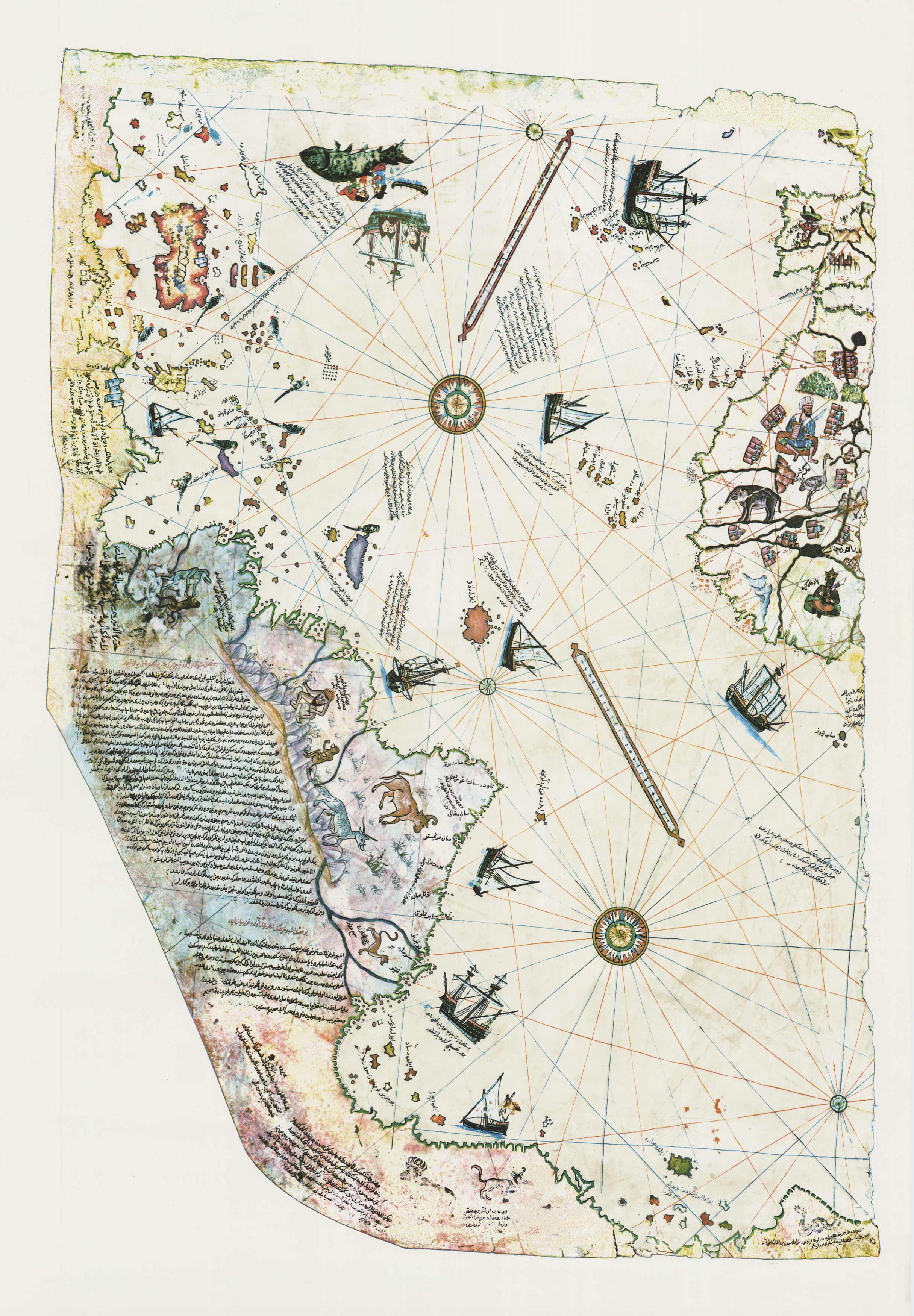
Some think the amount of conspiracy involving Antarctica is inane, and slightly disproportionate at best. The main conspiracy clusters seem to surround a few ideas. Operation Highjump, the chief among them, is rooted in two real events: the 1938–39 German expedition to Dronning Maud Land, and the 1946–47 U.S. military operation involving 13 ships and nearly 5,000 personnel. A 2007 paper in Polar Record, "Hitler's Antarctic Base: The Myth and the Reality," supposedly debunks this. Another largely popular theory, the Hollow Earth, traces to John Cleves Symmes Jr., a U.S. Army officer who spent his life pushing the narrative of a hollow earth accessible through the poles. His theory surfaced in Poe's The Narrative of Arthur Gordon Pym and remains the ancestral source of most of the related theories. Another I have frequently heard is the ancient civilization / Atlantis theory, which seems to draw upon Hapgood's crustal displacement theory. The theory which I have seen taking the most relevant public hit is one that belongs to the Flat Earthers: the "Ice Wall" theory. This one reframes the Ross Ice Shelf as the boundary wall of a disc-shaped world. Lastly, the important theory to note is that of Alien Technology, which is fairly adjacent to the ancient civilization theories and centers loosely around Admiral Byrd's post-Operation Highjump statements and is only aggrandized by the continent's general inaccessibility.
Recommended
-
To Read
Foundational
- The Antarctic Treaty (1959)
- Robert Falcon Scott, Journals (1913)
- Ernest Shackleton, South (1919)
- Apsley Cherry-Garrard, The Worst Journey in the World (1922)
- Richard E. Byrd, Alone (1938)
- Fridtjof Nansen, Farthest North (1897)
Papers
- Jouzel et al., "Orbital and Millennial Antarctic Climate Variability over the Past 800,000 Years," Science, 2007
- Mercer, J.H., "West Antarctic Ice Sheet and CO2 Greenhouse Effect: A Threat of Disaster," Nature, 1978
- DeConto & Pollard, "Contribution of Antarctica to Past and Future Sea-Level Rise," Nature, 2016
- Karl et al., "The Isolation of Lake Vostok and Its Relevance to the Study of Life on Other Planets," Nature, 1999
Geopolitics
- Jeffrey D. Myhre, The Antarctic Treaty System: Politics, Law, and Diplomacy (1986, Westview Press)
- Klaus Dodds, The Antarctic: A Very Short Introduction (2012, Oxford)
- Shirley V. Scott, "Ingenious and Innocuous? Article IV of the Antarctic Treaty as Imperialism"
- Gillian Triggs (ed.), The Antarctic Treaty Regime: Law, Environment, and Resources (1987, Cambridge)
History
- Stephen J. Pyne, The Ice: A Journey to Antarctica (1986)
- Francis Spufford, I May Be Some Time: Ice and the English Imagination (1996)
- Cornelia Lüdecke and Colin Summerhayes, The Third Reich in Antarctica: The German Antarctic Expedition 1938–1939 (2012)
Conspiratorial
- John Cleves Symmes Jr., various pamphlets (1818–1820s)
- Edgar Allan Poe, The Narrative of Arthur Gordon Pym of Nantucket (1838)
Notes
See Also
- .aq TLD (Placeholder)
- Antarctic Treaty (Placeholder)
- Operation Highjump (Placeholder)
- Admiral Byrd (Placeholder)